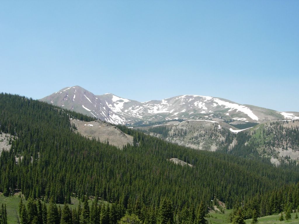
Winter and Spring of 2005 in the Colorado Rockies

Saturday, June 25, 2005


Our group at the end of the day

The Royal Gorge


This is getting into the Royal Gorge. I couldn't take pictures of any of the gnarly rapids as I was busy paddling. There is a suspension bridge (advertised as the worlds highest) which crosses the gorge over a thousand feet above the river. The rapids in the gorge had names like Sunshine Falls, Sledgehammer, Wall Slammer and Boat Eater and I had a front row seat.

Rafting the Royal Gorge


I went whitewater rafting for the first time ever today and it was really cool. I went with all of my cousins and some of their friends. We did a full day trip on the Arkansas River through the Royal Gorge with Performance Tours. It was largely Class IV-V rapids.

Friday, June 24, 2005


Interesting clouds and lighting at dusk over South Park. Driving down to Canon City to go rafting tomorrow.

Frisco BBQ Challenge


Frisco was hosting a big BBQ competition this weekend. It was pretty similar to some of the shows you see on the Food Network. Lots of people from all over the country who think they have the best food. I think there were over 100 entrants. Everyone had elaborate trailer mounted grills and smokers. This armadillo one was the best that I saw. You could generally get a sample from each competitor for a dollar or two. I spent about $20 gorging myself on samples of beef brisket, pulled pork and ribs. It was all very tasty.

Frisbee Golf

Summit County has a disc golf course on the shores of Lake Dillon near Frisco. I had heard it was a pretty nice course and today I got a chance to check it out. It was fun although the course doesn't have as much character as the UCSD one. I think I shot about 4 over which is pretty good considering I was playing with only a putter on an unfamiliar course.

Peak 10


Today I continued my attempt to climb peaks 1 through 10 in the Tenmile Range by climbing Peak 10. This time I did the easy route by driving to the top of the Breckenridge ski resort before beginning the hike. It was a pretty short hike up a mostly snow free jeep road. Peak 10 has a very prominent bowl on the north face which holds snow into the summer. It is named the "4th of July Bowl" and it is a tradition to hike and ski here on the 4th of July. I wanted to ski it while I was here, but my friends in town aren't as motivated as I am to go hike it. I didn't want to ski it alone so I hiked up and down today. Only peaks 1 and 2 to go.

Thursday, June 23, 2005

Biking


Today I went on a fairly long bike ride near Breckenridge. I rode up the hill past the base of Peak 8 and headed out onto the peaks trail. This doubletrack trail was a very difficult ride because it was very rocky. Just rocky enough that it wasn't much fun to ride. After a few miles I turned off onto some dirt roads which make up cross country trails at the Breckenridge Nordic Center during the winter. The trail was a steady ascent for several miles. I descended some fun singletrack that was marked as a triple black diamond cross country ski trail. Some sections were pretty steep, but not too tough (although I wouldn't want to ski it on cross country skis). It is interesting to use many of the same trails for different purposes in the summer and the winter. Trails within the ski resort that are easy to ski down (alpine skiing) are much tougher to hike on and probably impossible to bike down. In the winter, you really don't notice the steepness at all since you have so much control on skis. Sections that feel flat on skis can be quite fun to bike down. After the cross country roads, I headed home. Altogether about a 11mi loop. I feel my mountain biking skills are returning to me.

Tuesday, June 21, 2005

Weather Rant


Here is the typical summer weather forcast for Breckenridge. There might as well be no forecast as the forecasters have no idea what will happen. 30% chance of thunderstorms every day means that some days it will be clear and beautiful all day, some days the clouds will get threatening before noon, but nothing will happen and some days there will be thunderstorms, maybe around noon, maybe at 5 in the afternoon. You really can't tell what will happen until 11 or noon the day of. It is frustrating trying to plan outdoor activities with this type of weather. Basically you just have to get up really early to avoid it. It does make it so you can't really plan to do anything up high in the afternoon which greatly limits your options. This is one aspect of Colorado which I do not like at all. In California, the mountain weather seems to be much more predictable.


less than an hour later the sky looks like this and the clouds continued to build rapidly.


An example of the speed at which weather changes in Colorado. This picture was taken as a few clouds were just forming. Minutes before the sky had been crystal clear. The next picture was taken less than an hour later as the clouds had grown significantly. On my way down it looked like thunderstorms were imminent and it rained a bit. I did hear some distant thunder, but never saw any lightning. It is really difficult to predict what days the weather will be like this. The best way to avoid it is to be done hiking before 11am which is not really reasonable for longer hikes.


At the top of Red Peak with Hoosier Ridge in the background


left to Right Red Peak (13,215'), Hoosier Ridge (13,352') and Red Mountain (13,229').

Red Peak - 13,215' , Hoosier Ridge - 13,352' and Red Mountain - 13,229'


Today I climbed three mountains which are prominent on the Breckenridge skyline. Red Mountain, Hoosier Ridge and Red Peak are three thirteeners just south of town on the continental divide. The mountains are very different than the peaks in the Tenmile Range. They are much less rocky and more dirt covered (red dirt in fact, which probably gives the mountains their names). It was an interesting hike. I started at Boreas Pass and made a bit of a loop to bag the three peaks. These mountains are not heavily traveled (summit registers went back to the mid-90s with probably 50-100 people since then), but they provide great views of the Tenmile range and Breckenridge. It was an interesting hike, although I had to hurry at the end to avoid rapidly changing weather.

Sunday, June 19, 2005


Probably more impressive than my 8th and 9th fourteeners of the year, was my car's very first ascent of a fourteener. At 17 years of age it made it up effortlessly. Here it is resting at the top with South Park in the background.


The hike after The Sawtooth to the top of Mt. Evans was uneventful. It sure was crowded at the top though. You can drive all the way to the top of Mt. Evans so lots of people drive up for the view. It is a little 5 min walk to the actual summit block. I shared the summit with several hundred other people, but I'm pretty sure I was the only one carrying an ice axe and a big pack.


I had another encounter with a mountain goat out on the Sawtooth. He followed me for a while and eventually decided I was going too slow so he hopped on past me.


This is The Sawtooth ridge that traverses from Bierstadt to Evans. It is rated as a Class 3 scramble, but it wasn't too tough. The route was well marked the entire way and the exposure was minimal (despite how it looks in the picture). It did take me more than 2 hours to traverse from the top of Bierstadt to the other side of The Sawtooth. It was some of the more intersting hiking I have done this year.


There were lots of insects hanging out on the snowfields. I had never seen this before. They must have been trying to keep cool. I saw butterflies, beetles, ladybugs and lots of other bugs.


About to start scrambling up to Bierstadt from Abyss Lake. I tried to stay on the rocks as much as possible, but there were a few unavoidable snow patches.


Abyss Lake with part of the ridge between Bierstadt and Evans looming behind


Mt. Bierstadt (left of center) and Abyss lake from near where I started my hike.


Driving up the Mount Evans highway around 7am there were dozens of Marmots basking in the sun on the asphalt. They weren't too scared of cars or people either.

Mt. Bierstadt - 14,060' and Mt. Evans - 14,264'


Today Mt. Bierstadt and Mt. Evans were on the agenda. I had to drive nearly an hour and a half to get to the trailhead on the Mt. Evans highway. It was an interesting hike because I started hiking above 13,000' and immediately descended 1000' before starting up Bierstadt. The route was relatively short but contained a lot of scrambling which was fun. The guide book stated that this route minimized walking and maximized excitement. That was certainly true. I passed abyss lake on my way up Bierstadt. From Bierstadt I traversed the Sawtooth ridge to the top of Evans. I descended Evans south slope crossing the road several times while heading back to my car. These were my 8th and 9th fourteeners of the year. I had climbed Mt. Bierstadt before, probably about 10 years ago, via a different route.